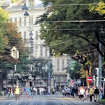
As a visitor, you might be forgiven for thinking the Vienna city planners put a huge boulevard around the historical old town (the so-called Ring or Ringstrasse) as a convenient bus route. The reality is a touch different.
- Built across the late 19th-century
- Replaced the old city fortifications
- Public and private initiatives used the “roadside” for monumental construction works
- Book a themed guided tour* for Vienna
- See also:
The origins of the Ring

(Excerpt from an 1821 plan of Vienna published by the Artaria & Co. Verlag. Note the open spaces and thick fortifications that separate the old town from the rest of the city; Wien Museum Inv.-Nr. 238980/106; excerpt reproduced with permission under the terms of the CC0 licence)
Forged in the fires of Mount Doom by the Dark Lord Sauron (ah, sorry, wrong ring). So, returning from Middle Earth to the middle of Europe…
The Ring formed part of the vast changes to the Viennese cityscape that took place in the second half of the nineteenth century.
After the somewhat bloody and brutal end to the 1848 revolution, Vienna quickly entered a period of relative prosperity (depending where you were in the social hierarchy). It was, after all, the administrative and cultural center of the vast Habsburg empire presided over by Emperor Franz Joseph I.
The city’s formal boundaries soon expanded to include outlying settlements, and this put fuel on the fire of what to do with the huge fortifications and narrow gateways that protected the original limits of historical Vienna.

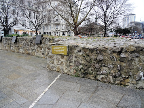
(Some of the old city fortifications)
As the economy blossomed, the business community and others wanted easier access to the town centre and use of the real estate currently occupied by walls, trenches and the so-called Glacis.
This Glacis was an area in front of the fortifications kept largely free of building clutter to ensure a lack of cover for besieging armies and a clear view for the defenders. A justification that now seemed rather redundant given artillery improvements and similar.
That civil pressure didn’t sit well with the military, who wanted to keep the fortifications and glacis as a plausible line of defence in case the underclasses got frisky again.
After much debate, the Emperor himself took an executive decision in 1857 and decreed that the city walls be torn down, the trenches filled, and the Glacis opened up for development.

(Removing the Kärntnertor fortified gates and walls at the Opernring in 1863; Wien Museum Inv.-Nr. 14512; excerpt reproduced with permission under the terms of the CC0 licence)
The aim was to create a new boulevard around the old town made up of seamlessly-connected streets and lined by various civic buildings. All designed to reflect the Imperial grandeur of Vienna and its ruling dynasty.
The remaining land was thrown open to private initiatives. Indeed, much of the money for all the state buildings and infrastructure came from selling off that prime real estate.
As you might expect, the prestigious nature of an address along this boulevard attracted the wealthy to construct, for example, various magnificent townhouses alongside the public buildings.
Businesses took advantage, too. So you had the phenomenon of the Ringstrassen cafés; one or two survive today.
The first part of the Ring opened in 1865 and subsequent years saw the completion of all those museums, political institutions, and other sites of renown we see today.
The scale of this accomplishment seems quite extraordinary when you consider the length of the boulevard (around 6.5 km) and the number of grand buildings that went up in a relatively short period of time.
And yet they never implemented the full monumental plan for the Ring, thanks largely to money issues and the end of the Habsburgs.
The start of WWI, for example, gave the empire other things to worry about. And the small fledgling republic that succeeded that empire after the war had better uses for its scarce resources than recreating Imperial pomp.

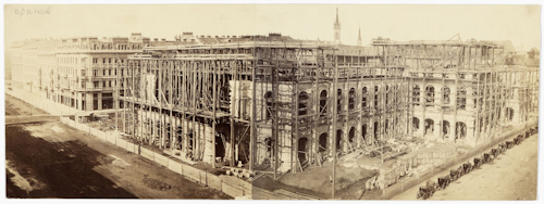
(Construction work on the State Opera House in 1865, photographed by Andreas Groll; Wien Museum Inv.-Nr. 14516; excerpt reproduced with permission under the terms of the CC0 licence)
Why is the Ring important?
The efforts of those 19th-century architects have left us with a long and wide, tree-lined boulevard, as well as numerous buildings to admire.
Indeed, many of Vienna’s most famous locations live on the Ring: museums, squares for big annual festivals, parks, luxury hotels, etc.
As such, the Ring remains a critical part of the urban landscape. And the perfect venue for public displays, whether demonstrations or parades.
(And the Ring really does make a lovely route for bus tours.)
Where to learn more
The history of the Ringstrasse remains preserved in the modern cityscape, of course, so easily viewed on foot or by vehicle: the main article on the Ring has suggested options.

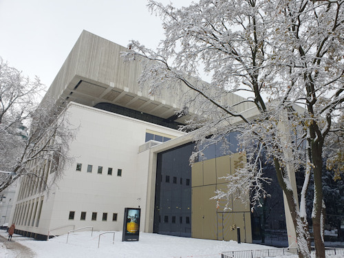
(The Wien Museum)
The permanent exhibition at the Wien Museum on Vienna’s history and culture does, however, include a section devoted to that period of urban development.
That institution also covers those aspects of the Ring construction era you rarely hear about; the period was not famous for progressive employment rights, and living conditions for construction workers could rarely be described as humane.