The Ring is the popular name given to a series of wide boulevards that encircle almost the entire center of the city. It’s about 6.5km long and (possibly) has a greater number of historical sights lining its edges than any other road in the world.
- Flanked by many of Vienna’s top sights
- Great for bikes and pedestrians, too
- Book a themed guided tour* for Vienna
- See also:
- Self-guided walking tour: the Ring part
- History of the Ring
What can you see?
(The Ring temporarily closed to traffic. This often happens for parades, but also for registered demonstrations)
The Ring, which surrounds the first district (Vienna’s old town), is one of the city’s most prestigious addresses.
Various luxury hotels and restaurants occupy spaces either side of the road, for example. But the route also has numerous museums, squares, gardens and civic institutions of particular interest to visitors.
Along the Ring you’ll find, for example:
Civic buildings
- The Rathaus town hall with its huge square and park that host various festivals through the year
- The Hellenic-style Parliament building
- The Justizpalast home to the Supreme Court
- The University of Vienna
Music & theatre
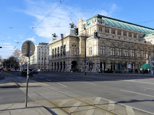
(The Staatsoper state opera house faces the Ring)
- The Staatsoper, one of the world’s most prestigious opera houses
- The Burgtheater national theatre
- The Neorenaissance Kursalon concert venue
- The old Stock Exchange concert/event venue
- Palais Eschenbach, home to two prestigious national associations and also a concert/event venue
History & museums
- The Kunsthistorisches Museum, notable for its paintings by old masters and other art collections
- The Naturhistorisches Museum for all things natural history
- The Neue Burg palace wing housing, for example, the Weltmuseum
- The MAK applied arts museum
- The 1879 neogothic Votivkirche church
- The 1910 Jugendstil Urania building
- Various monuments to the likes of Radetzky, Goethe, Grillparzer, Maria Theresa, Liebenberg, and Schiller
Parks & gardens
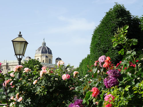
(Roses in the Volksgarten)
- The Burggarten behind the Neue Burg
- The Volksgarten with its lovely rose garden
- The Stadtpark with its famous Strauss statue
And more…
- The Ringturm “skyscraper” and exhibition venue
- The Donaukanal channel of the Danube
- …etc.
Most of the buildings went up between 1869 and 1888 as part of a giant urban construction project. The initiative combined municipal and imperial works with new city residences for successful business owners and the nobility.
The 19th-century construction dates often come as a surprise, since everything looks much older. People sometimes confuse the Votivkirche, for example, with a medieval cathedral. We can thank the prevailing architectural approach to such things at the time: historicism.
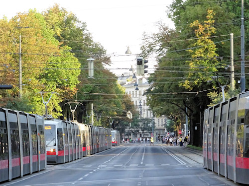
To see the Ring in all its finery, simply hop on a tour bus or a local tram (see below). Cycle paths and wide footpaths follow the same roads, too.
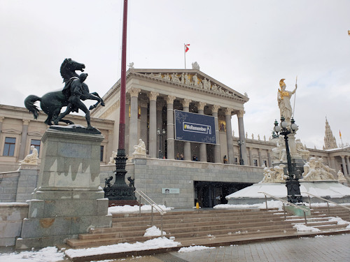
(The Austrian Parliament: one of many Ring sites)
If sticking to public transport, look for tram line 1. Catch it at Julius-Raab-Platz in the direction of Stefan-Fadinger-Platz.
This takes you around almost the entire Ring clockwise before the tram turns off at Oper/Karlsplatz (or go in the reverse direction from Oper/Karlsplatz to Julius-Raab-Platz on the same line but use the tram going in the direction of Prater/Hauptallee).
You might prefer to take a turn of the Ring after dusk. Once the sun goes down, the buildings light up, often spectacularly. And at Christmas, you have the added bonus of the seasonal displays and decorations.
So how did this great boulevard and its wealth of historic buildings come about?
Well, I have a whole article on that, if you’re interested in the history.
The short version is that military advances across the 1800s meant city walls lost their defensive value and essentially just got in the way of traffic. So they tore them down and removed building restrictions on the areas in front of those fortifications.
This released a large circular band of land around the old town for development, which the state used for the Ring and its numerous representative buildings and institutions. And others bought plots for townhouses and businesses on what was clearly going to be a top address.
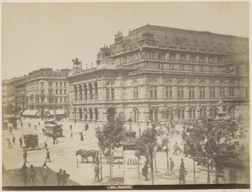
(The finished State Opera house in the late 19th century with the new Ring in front of it. Image courtesy of the Rijksmuseum)
Finally, a couple of bits of trivia for you.
As mentioned right at the start, the Ring or Ringstrasse actually consists of a series of Ring streets: the so-called Ringstrassen. These are Stubenring, Parkring, Schubertring, Kärntner Ring, Opernring, Burgring, Dr- Karl-Renner-Ring, Universitätsring, and Schottenring.
(And where the road follows the Danube canal in the northeast, it’s called Franz-Josefs Kai.)
Given its size and grandeur, you can often spot the Ring in TV and movie productions. One example is the chase scene in the first season of The Recruit.
The boulevard plays a bigger role in the iconic movie, Before Sunrise. One of the more notable conversations between protagonists Jesse and Céline takes place in a tram travelling some four stops around the Ring.
Romance, history, architecture, green spaces, museums, cafés and convenient transport options: what more could you ask for?